An official website of the United States government
Here’s how you know
Official websites use .gov
A .gov website belongs to an official government organization in the United States.
Secure .gov websites use HTTPS
A lock (
) or https:// means you’ve safely connected to the .gov website. Share sensitive information only on official, secure websites.
-
//
- Census.gov /
- Newsroom /
- Stats for Stories /
- National GIS Day: November 18
Stats for Stories: National GIS Day: November 18
Key Stats:
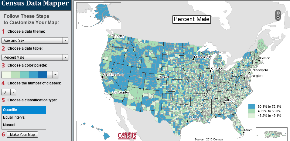
This application is intended to provide users with a simple interface to view, save and print county-based demographic maps of the US. The data are from the 2010 Census.
More Stats:
Geography is central to the work of the Census Bureau, providing the framework for survey design, sample selection, data collection, tabulation, and dissemination. Geography provides meaning and context to statistical data.
Make new discoveries about your neighborhood with Census Explorer, the U.S. Census Bureau’s interactive map series.
From the 2013 County Business Patterns.
Many of the 2010 Census Demographic Profiles are ready for viewing. These profiles provide more subject detail than the recently released 2010 Census redistricting data files. These profiles provide details about race and Hispanic groups, age, sex and housing status. The profiles will be released on a state-by-state basis for each of the 50 states, the District of Columbia and Puerto Rico. Use this map to explore 2010 Census Demographic Profile data.
Share
You May Be Interested In
Facts for Features & Special Editions
Facts for Features
Facts for Features consist of collections of statistics from the Census Bureau's demographic and economic subject areas.
Facts for Features
Facts for Features consist of collections of statistics from the Census Bureau's demographic and economic subject areas.
 Yes
Yes
 No
NoComments or suggestions?


Top


